Powered By
The Experts in 3D Laser Scanning and Point Cloud Processing
Our products and services are suitable for industrial sites, offshore installations and vessels, architecture, heritage, and large-scale urban regeneration projects using the latest laser scanners: ZF Imager 5010C, ZF Imager 5010, Reigl VZ-400 (long-range), and Leica Total stations for control measurement.
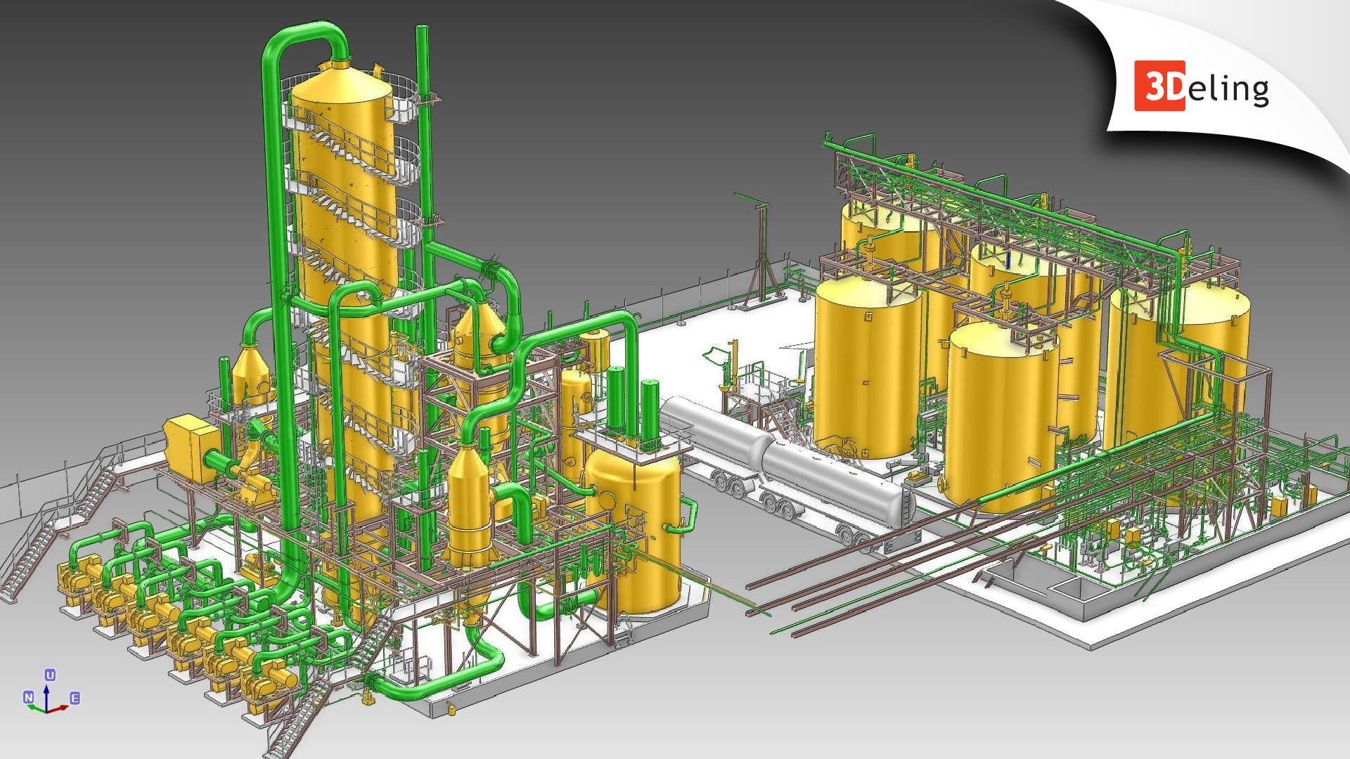
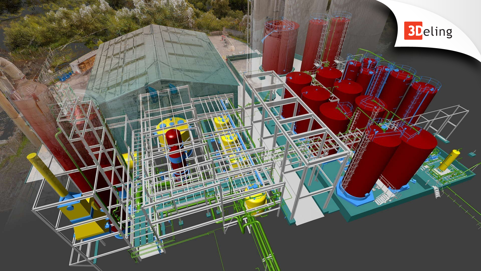
We produce as-built surveys and clash detection analysis for a range of industrial applications like power stations to oil installations. Utilizing point cloud data as a basis, we can provide a bespoke product to suit your particular need. Whether it is 3D CAD-based (DWG, DGN, etc.) or intelligent PDMS databases and models, our team will elaborate with you to provide a solution to your unique requirements.

Applications For 3d Laser Scanning

We produce as-built surveys and clash detection analysis for a range of industrial applications like power stations to oil installations. Utilizing point cloud data as a basis, we can provide a bespoke product to suit your particular need. Whether it is 3D CAD-based (DWG, DGN, etc.) or intelligent PDMS databases and models, our team will elaborate with you to provide a solution to your unique requirements.

Utilizing our extensive experience BGS/3Deling provide highly accurate documentation for the heritage sites. As well as 2D or 3D CAD deliverables we can also supply a range of photographic or scan-based products from panoramic imagery, virtual tours and walkthroughs to high-resolution orthoimages.
3D laser scanning can be utilised to capture large urban areas. The point cloud information can be further use to support your planning and design needs. Our products include 2D or 3D topographical surveys, 3D modelling for Rights of Light analysis and 2D or 3D models for the production of contextual elevations.

Our reverse engineering services include accurate even sub-millimetre geometric analyzes of small elements and objects. We generate precise 3D CAD models and create 2D technical documentation.

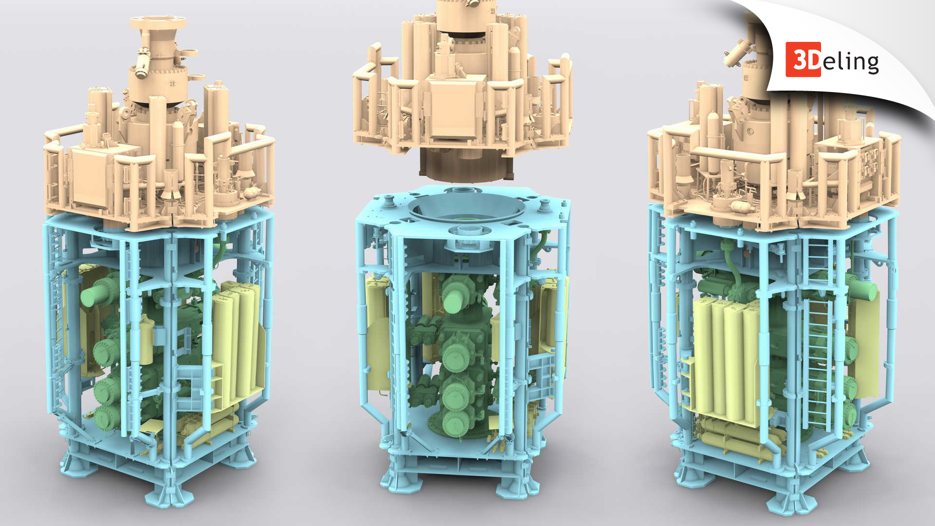
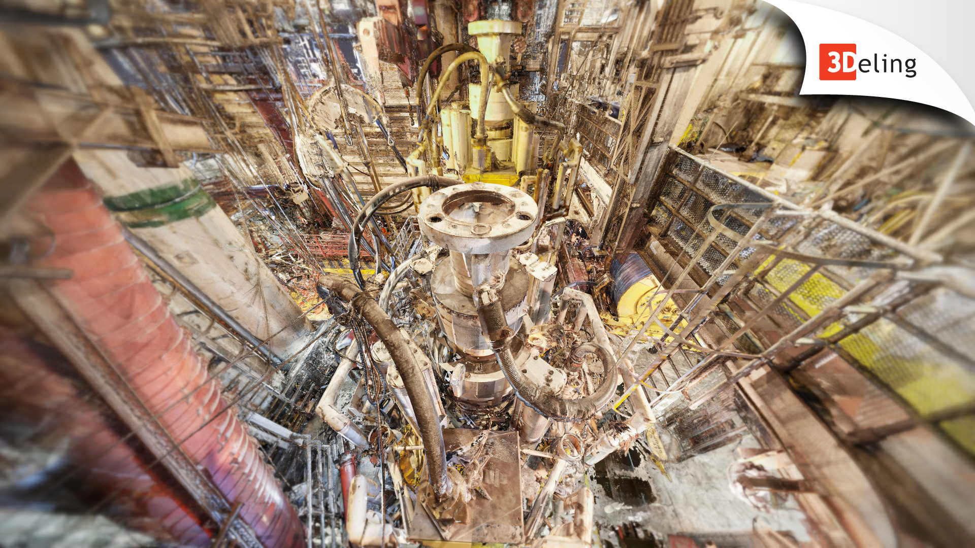
We offer as-built surveys for offshore installations (oil rigs) and vessels.
We have safety training for the offshore industry accredited by OPITO & NOGEPA.

We offer as-built surveys for offshore installations (oil rigs) and vessels.
We have safety training for the offshore industry accredited by OPITO & NOGEPA.
3DELING LASER SCANNING SITE WORKFLOW
This video presentation takes you through our custom laser scanning- site workflow. We place a great deal of emphasis on the quality of our deliverables. On request, we are happy to supply our survey network adjustment and registration reports.
For larger sites, we install, measure and adjust a combination of scanning targets and retro targets which are controlled via total station observations. Along with the scan data we can also supply a coordinate list of the retro targets which will be left on site.
OUR PRODUCTS
3D mesh models
Ideal for irregular or organically shaped objects.
Plant design models
We can covert point clouds to Aveva PDMS, CADWorx, and Open Plant models.

Orthophoto
We offer Orthophotos – metric images commonly specified for heritage sites.
Deformation surveys
We offer deformation surveys and movement monitoring.
3D CAD models
We offer a range of 3D CAD models, in different formats and levels of detail to suit your needs.

Volume surveys
We offer highly accurate and fast volumetric surveys utilizing laser scanning technology.

Right of Light Surveys
We offer 2D or 3D modeling tailored specifically for use within the Rights of Light analysis.

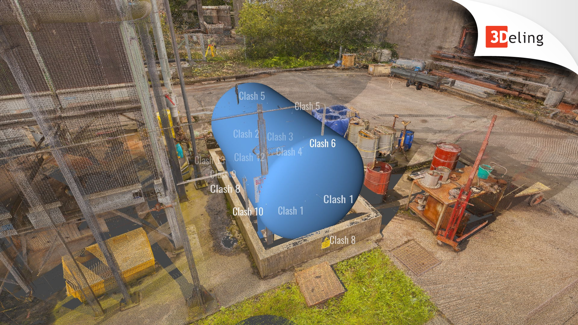
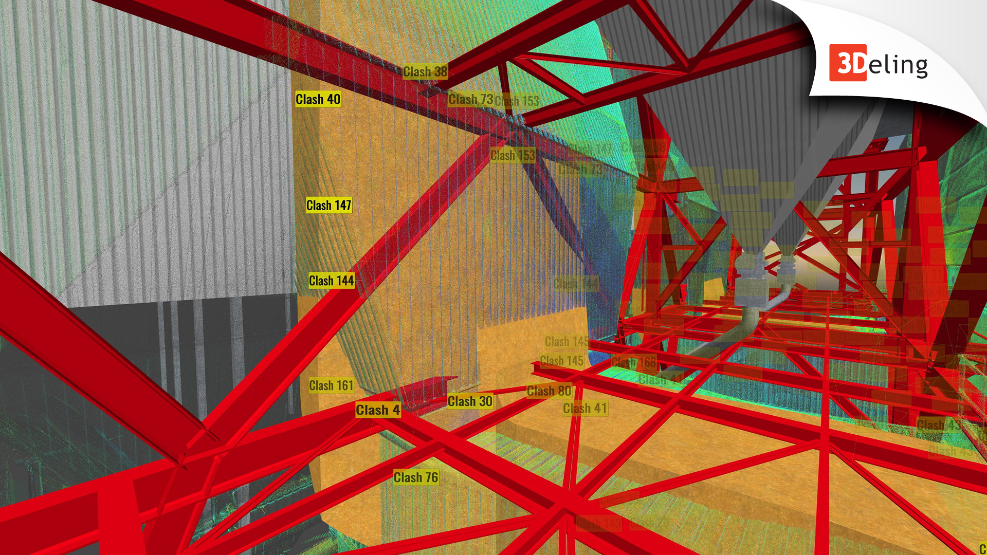
Construction Verification
We can perform clash detection analysis, comparing either design model to cloud or cloud to cloud.
BIM Ready models
We can convert a point cloud to Revit, AECOSim or ArchiCAD models to your specific specification

Registered Point cloud
For clients that want to complete their own post-production, we can scan and supply a registered point cloud.

3D virtual reality
We can digitize a specified object or space and create a game-like environment with interactive 3D walkthroughs.

Panoramic Tours
Panoramic Images can be supplied referenced to a sitemap allowing the user to navigate around the site in a product called PanoTours.
2D CAD documentation
Highly accurate floor plans sections and elevations can be generated in a variety of formats and levels of detail, tailored to suit your specific requirements.

TOPO
2D or 3D topographical information can be extracted from point clouds. This can be supplied in a variety of formats and levels of detail which can be tailored to suit your specific requirements.

Scan registrations
We offer the registration of supplied scan data for any size of a project. We have past experience in handling projects with over 5000 individual scan positions.

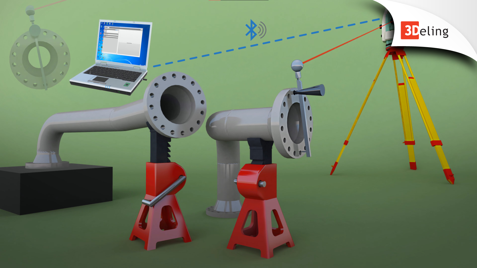
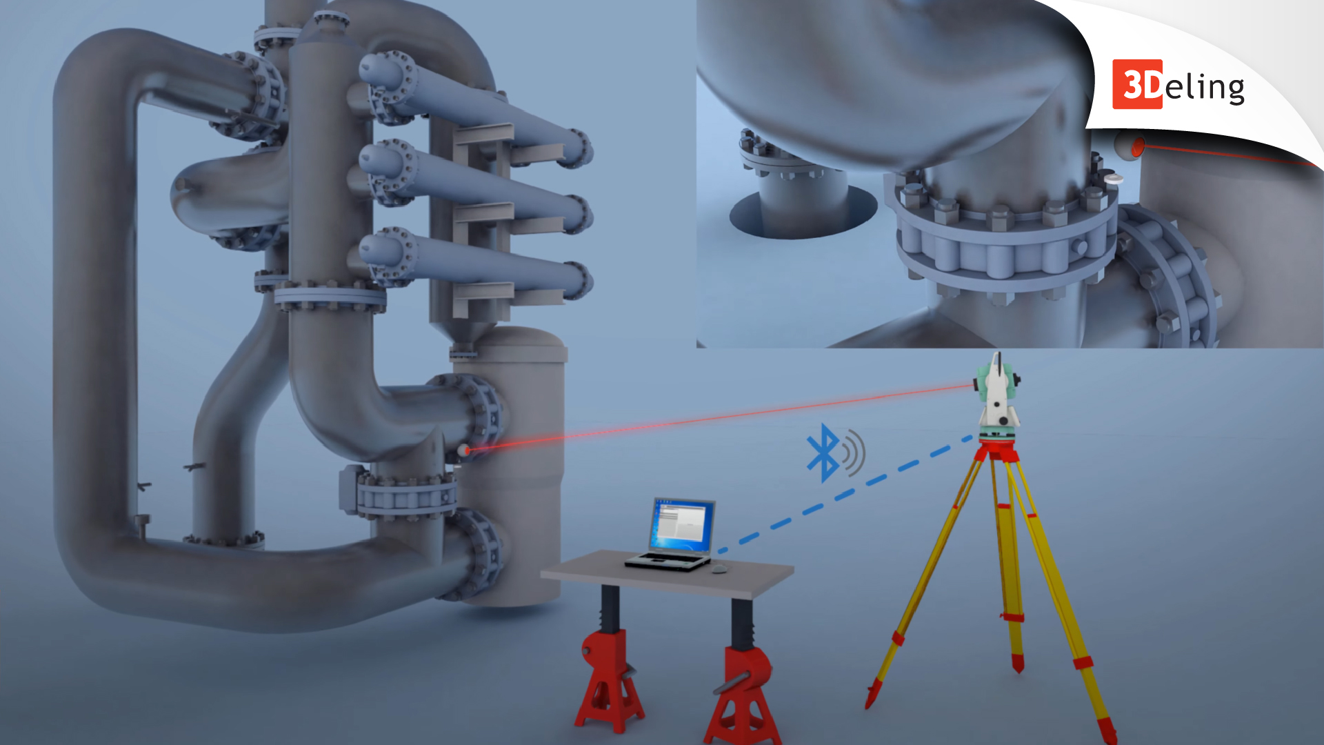
Dimensional Control
We offer highly accurate industrial measurement services, mainly dedicated for spool inspection.